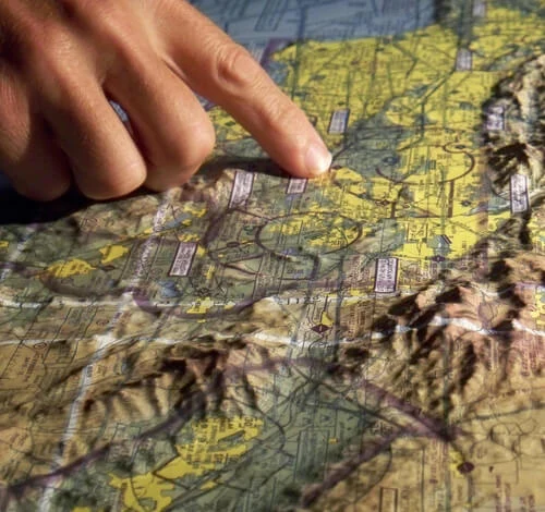
Image for illustration only. It may show a product series rather than the exact product offered.
RX1-13-09596
3D Aero Chart San Fran/Tahoe
78.50 EUR/EA
Excluding VAT
Availability
Up to 1 EA ready to ship on Thursday 2026-11-12Order before 16:00 CET Today
Part numbers
- Roctexo
- RX1-13-09596
- Manufacturer
- 3D SAN FRAN
- Vendor
- 13-09596
Product details
The 3D Aero Chart San Fran/Tahoe is a three-dimensional aeronautical terrain chart depicting the central California region from San Francisco to Reno/Lake Tahoe, including Yosemite and Mammoth.
Produced by digital inkjet printing on rigid plastic film and moulded to a terrain model, it provides a tactile, visual representation of terrain in relation to the charted airspace and flight environment. Suitable for flight-planning reference, training environments, offices, hangars or display use.
- Manufacturer part number: 3D SAN FRAN
- Coverage: San Francisco to Reno/Lake Tahoe, including Yosemite and Mammoth
- Scale: 1:500,000
- Approximate size: 760 × 510 mm
- Rigid, precision-moulded 3D terrain format
- Unit of measure: each